
Canadian History With New Eyes: The Dark Ages?
The Dark Ages & the French Wars of Religion Some time ago, I started to
Home / Yonge Street, Simcoe & Lutheran Berczy
And if you live in Markham, thank them again.
This is the story about the people who laid down the foundations of one of the first communities in Upper Canada (Ontario). These were the first settlers who cut down trees and built roads with none of the technology we have available today. They laid out the township which many residents enjoy today. Historical markers and cemeteries tell their stories.
This is important because many people either don’t know or don’t care about the sacrifice made by others in the past so they could enjoy their good lives today. Here is a quote worth remembering: ‘Stand by the roads, and look, and ask for the ancient paths, where the good way is; and walk in it, and find rest for your souls. But they said, ‘We will not walk in it.’ (Jeremiah 6:16).
This is a story of ‘the old paths’ of hard work and self sacrifice which built our nation; a story of the influence of a Christian faith and the belief in the values of diligence, perseverance, faith, and the family working together to build a community. This is how it started.
In a nutshell, the War of American Independence took place from 1775 to 1776. After the war, soldiers loyal to the British cause were given land to settle in Canada. These were called ‘Loyalists’ and settled in Lower Canada (Quebec) and Upper Canada (Ontario). Loyalists also settled in Nova Scotia and New Brunswick. The Loyalists of Upper and Lower Canada included Scottish regiments, other Americans and Natives of the 6-Nation Confederacy of New York (Mohawks, Senecas, Cayugas, Tuscaroras, Oneidas and Onondagas) led by Thayendenega or Joseph Brant.
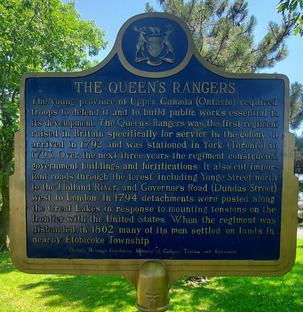
George Simcoe, the first Governor of Upper Canada, was given the responsibility of allocating lands to the loyalists in Upper Canada (Ontario). Many who settled here belonged to his regiment called ‘The Queen’s Rangers’.
In 1794, William Berczy, a German, led a group of immigrants from Europe, first to New York and then to Upper Canada where they established the Township of Markham. This article is essentially their story. Remember to thank them again.
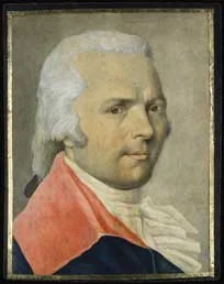
William ‘Moll’ Berczy
(Copyright: Art Gallery of Ontario, Toronto. Gift of Mr. John Andre, Toronto, 1981)
William ‘Moll’ Berczy brought a group of about 200 people, representing 64 families, from Germany to Canada.
They were part of a project by an American consortium of sorts, who promised immigrants from Europe, settlement in return for their service to build roads around Genessee New York. Conditions were not what they expected and Berczy moved them, at great personal difficulty and expense, north to Upper Canada (Ontario).
They helped Governor Simcoe build the longest road in Canada – Yonge Street, from Lake Ontario to Lake Simcoe. They also formed the nucleus of the Township of Markham.
The Queen’s Rangers was the first regiment raised in Britain specifically for service in Upper Canada. They were stationed in York (Toronto). From 1793 to 1796, the regiment constructed government buildings and fortifications.
Together with Berczy’s settlers, they cleared forests to build roads like Yonge Street, which stretched from Lake Ontario to Lake Simcoe, and Governor’s Road (Dundas Street) which stretched from York (Toronto) west to London.
For many years after the American Revolution, there were various causes for tensions between the British, as represented by Upper Canada (Ontario), and the United States. One such occasion was in 1794. when the Queen’s Rangers were again posted along the Great Lakes in response to such a threat.
The issue this time resulted in a treaty called ‘Jay’s Treaty’ which had implications for determining the southern border of Upper Canada and the extent to which Natives from upstate New York could travel freely between the US and Canada.
The regiment was eventually disbanded in 1802 with many of the men settling in nearby Etobicoke.
They arrived in June 1794, just as the Queen’s Rangers were dispatched to deal with border issues with the Americans. The Rangers had been clearing forests and building Yonge Street. Berczy’s settlers took over the task from the Rangers. At the same time while building Yonge Street, they built a road through their Markham settlement, they built their own houses, mills, stores, storehouses AND their church – Bethesda Lutheran Church.
Mounting prices and shortage of supplies made it impossible for Berczy to complete the road in a year as he had first agreed. Nevertheless, these settlers established Markham and laid the foundation for one of the longest surviving churches in Ontario – the Bethesda Lutheran Church.
By 1795, Berczy was compelled to meet the needs of his settlers and by 1796 they were close to starvation. So desperate was their situation that in the winter of 1795-96, one third of the settlers moved to Newark (Niagara-on-the-Lake). In 1796 the land grant was almost forfeited by Governor Simcoe because in his eyes, Berczy had failed to meet his obligations as a settler.
This issue was never adequately resolved. Berczy suffered great personal loss to help others settle in Canada and died trying to get the compensation he deserved. His legacy lives on in the town of Markham and the longest street in Canada – Yonge Street.
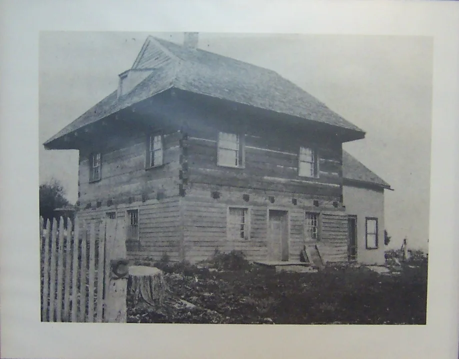
This house was one of Berczy’s settlers’ house.
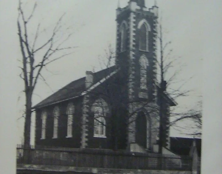
This is the original Bethesda Lutheran Church. It has since been moved to Unionville and renovated when many of the settlers moved there.
")
Among the Berczy settlers was Rev. S Liebrich who established the congregation. Their church history lives on in this historical plaque.
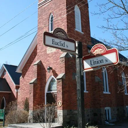
The new renovared church in Unionville.
Yonge St earned this distinction because north of Toronto it morphed into Highway 11, continuing through towns, cottage country and wilderness for 1,896 kilometres (1,178 mi). Take a stroll down to Toronto’s waterfront, and just to the east of the Hilton Hotel, embedded in the sidewalk at the foot of the street, you’ll find brass plaques marking the distances to key cities in Ontario. Until 1998 Guinness recognized this as the longest street in the world. Whether it still is, is up for debate, because of changes in the roads near Barrie.
You can see a bronze map of Yonge St’s route embedded in the sidewalk at the north end of the Eaton Centre, just across from Dundas Square. From the plaques at the foot of Yonge St it’s just a two-minute walk to the ferry dock for the Toronto Islands.
(http://www.canadacool.com/location/yonge-st/)
Author’s Note: Lynette is the owner of ChristianRoots Canada. Blogger. Publisher. Course Creator. Passionate about Canadian History from the perspective of God’s Providence.
The Dark Ages & the French Wars of Religion Some time ago, I started to
In many places, like legislatures and schools, the Bible is considered ‘hate literature’. Counseling someone
Dominion Day had been a federal holiday that celebrated the enactment of The British North American Act which united four of Britain’s colonies – Nova Scotia, New Brunswick, Upper and Lower Canada (which became Ontario and Quebec), into a single country within the British Empire, and named that country The Dominion of Canada.
Britain’s claim of Rupert’s Land by the Doctrine of Discovery, proved to be one of